As part of my learning routines, I’m reviewing my knowledge on reservoir modeling, particularly on static reservoir modeling workflow through a public course from March to October 2024. The course using the Gulfaks field, an oil & gas field located in the Norwegian part of the North Sea shelf that operated by Statoil since 1986, as the demo data. Throughout this course, I learn a complete workflow of reservoir static modeling, from data loading to volumetric calculation.
The Gulfaks Dataset
The Gulfaks known as a classic North Sea oil field with rotated fault blocks trending in a North-South direction & produces oil from Middle Jurassic sandstone in the Brent Group (Tarbert Fm, Ness Fm, and Etive Fm), and from Lower Jurassic and Upper Triassic sandstone in the Statfjord Group and Cook and Lunde Formations.
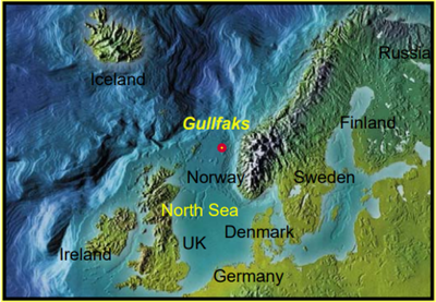
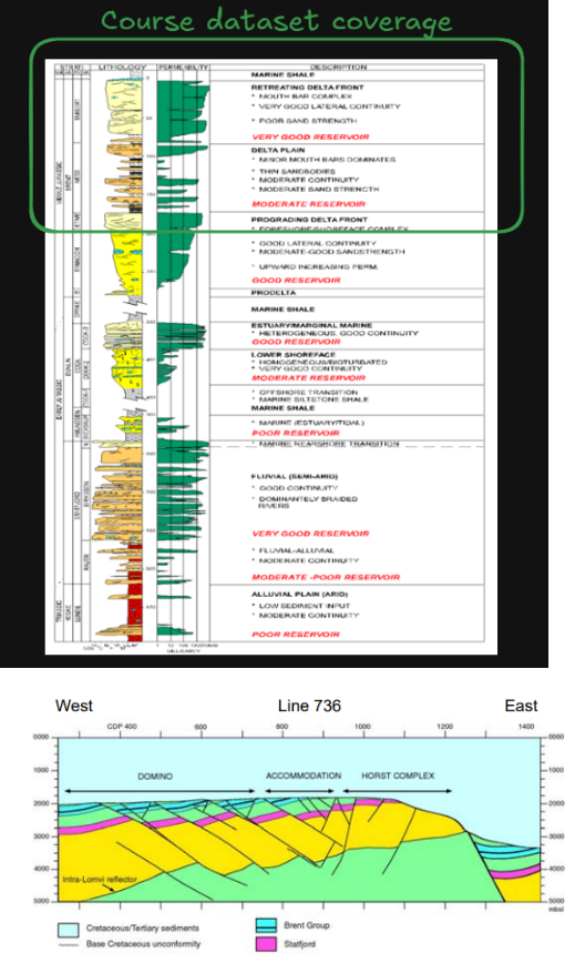 Figure 1. Gulfaks field location
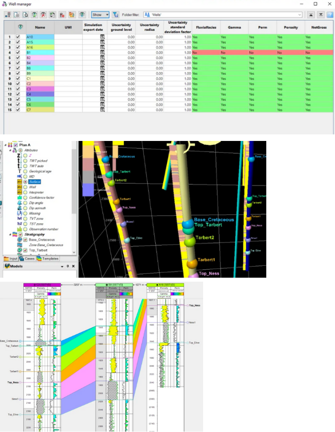 Figure 2. Data loading (tops, log, and deviation)
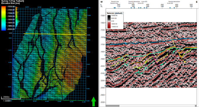 Figure 3. Seismic interpretation
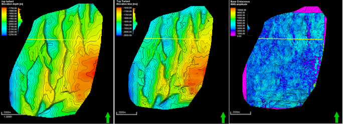 Figure 4. Surface map (depth, time, & RMS attribute)
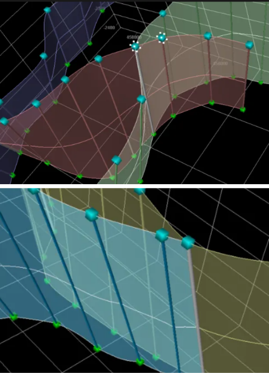 Figure 5. Fault modeling (manual & automatic)
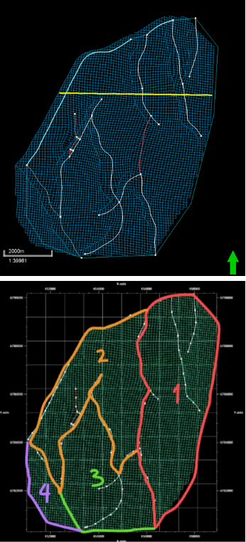 Figure 6. Pillar gridding (boundary & segment)
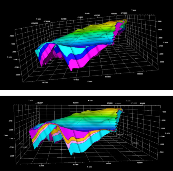 Figure 7. Zonation & layering (Z-gridding)
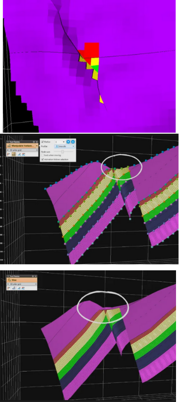 Figure 8. Geometrical modeling & grid QC
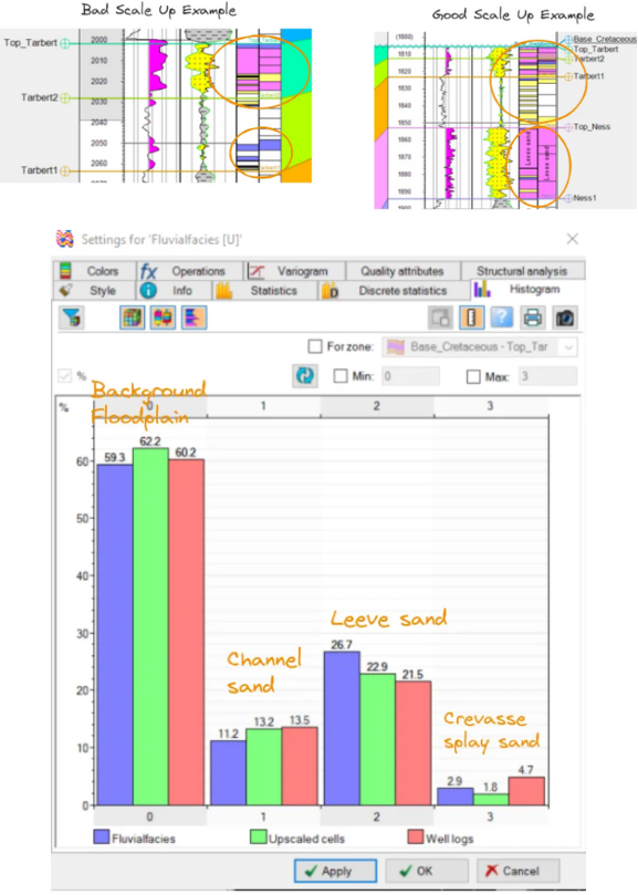 Figure 9. Well log upscaling
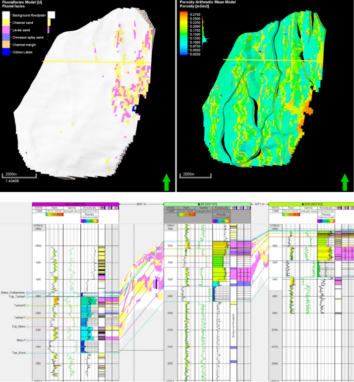 Figure 10. Property modeling (facies & petrophysical)
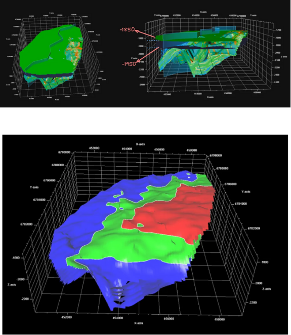 Figure 11. Hydrocarbon contact map
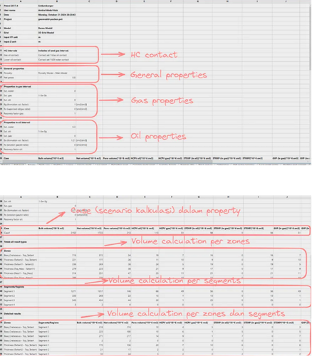 Figure 12. Volumetric calculation